Over 10 years we help companies reach their financial and branding goals. Engitech is a values-driven technology agency dedicated.

Gallery

Contacts

411 University St, Seattle, USA

contactus@lucidpath.io

+1 -800-456-478-23

3D Modeling GIS Services

Get unlimited access to our top-quality and professional 3D Modeling GIS services.

Make the most of the information or data through Lucidpath’s 3D Modeling GIS services

3D GIS is the addition of another dimension (the z coordinate) to an already existing 2D dimension (the x-y coordinates) to create a new 3D GIS model. Lucidpath’s deep expertise and vast experience in GIS 3D modeling services help various businesses make the most of the information they have by adding a new dimension to data collection and analysis. We help businesses create a detailed, descriptive, and interactive 3D model that helps in various purposes ranging from urban planning, urban construction, transportation development, virtual tours, land purchase, etc. Our expert professionals in GIS mapping and GIS 3D modeling teams help businesses see data from a different perspective that helps in making smart decisions that assure no financial loss. Our services include construction, town planning, etc.

Integration of BIM with 3D GIS for building robust model

Building information modeling in combination with 3D GIS technology helps in effective planning by building a robust model that helps in producing an error-free building plan. BIM is a technology that depicts the real-world settings of an environment. Our expert team of professionals, who have deep expertise in both technologies and the experience acquired by handling clients daily, help businesses have strong planning and architecture throughout the project as per their requirements. With their experience, our team members know how to use both technologies effectively after their integration. Our 3D GIS with BIM technology integration services are cost-effective and help businesses improve efficiency, quality, sustainability, and environmental impact. Companies can have a more detailed analysis of data than before, which is best for your business.

Our 3D Modeling GIS services include

01
Town planning
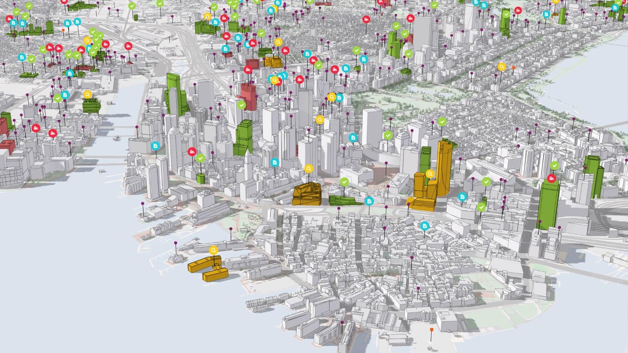
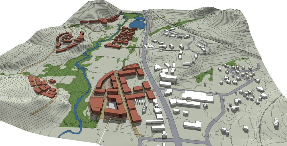
Our 3D Modeling GIS services make town planning easy, effectively finding the best solutions and resolving crises. We help town planners and city planners by using a 3D Modeling GIS platform with ease that helps them have a detailed visualization of data. They can plan according to the data and make smart decisions. Crucial data like building information, satellite data, traffic conditions, infrastructure locations, surroundings information, etc. is found in a 3D GIS model with more clarity than before making town planning effective and making the world a better tomorrow.
02
Construction
Through our 3D Modeling GIS services, we help businesses develop a strong strategy for the construction of large-scale projects that helps them finish construction and deliver to clients within their time limit and allocated budget. A 3D view makes things simple for a project manager as it gives complete control over important construction parameters like time, money, and quality, which is possible by using a GIS-based project management system. Our expert professionals will guide you whenever required.

Why choose 3D Modeling GIS?

Effective planning management

The help of detailed visualization of data that covers necessary information which helps to form a strong planning strategy that results in effective planning management.

Smart decision-making

3D Modeling GIS helps businesses to make smart decisions about planning, construction, virtual tour preparation etc. they choose, which helps in targeting the right audience.

Improved visualization of data

Through 3D Modeling GIS, businesses can have improved visualization of data as there is one more dimension added that can cover data like positions of aircraft, urban area population density, depths of underground wells, etc. as per their project requirements.

Improves environmental impact

3D Modeling GIS improves the environmental impact by creating a plan that saves the environment from natural disasters, fire-related threats, floods, etc. The accurate geospatial information acquired from this model helps in anticipating the areas that are required for planning and executing disaster response.

Why Should You Choose Lucidpath’s 3D Modeling GIS Services:

Our years of expertise, experience, and proven track records ensure your business remains on top of every competition, always.

Customer satisfaction

Lucidpath has all the expertise, resources, and tools necessary to deliver top-quality, professional 3D Modeling GIS services to clients that assure 100% customer satisfaction.

Expertise Driven By Experience

You will be working with an elite group of professionals who are certified and have extensive expertise in this field.

One-stop shop

Lucidpath is a one-stop shop for any activity or query related to 3D Modeling GIS services that are required for your business, as we have deep expertise and vast experience we acquire by handling clients regularly.

Cost-effective

We offer rich-quality 3D Modeling GIS services at affordable prices that help your business make the most of the map’s data, which helps in the proper usage of a property or land, etc.

Effective data management

Our team of expert professionals helps in effective data management that improves the reliability, scalability, and performance of your business as we help in using the data wisely and at the right places, as data is key for any business.

No quality compromise

Lucidpath will never compromise on the quality of its 3D Modeling GIS services, as our main aim is to deliver the best for our customers.

// latest case studies

Case Studies

Software development outsourcing is just a tool to achieve business goals. But there is no way
to get worthwhile results without cooperation and trust between a client company.

Innovative 3D GIS Solutions by Lucidpath

Lucidpath’s 3D modeling GIS services are in high demand due to their ability to provide highly accurate and realistic 3D models that can be used for a wide range of applications such as urban planning and construction management. The service provides an interactive way of visualizing data that can help with decision-making and planning.
Bespoke 3D Modeling GIS service with precise business outcomes

Let's Forge A Path Forwards Together